TURNS NIGHT INTO DAY
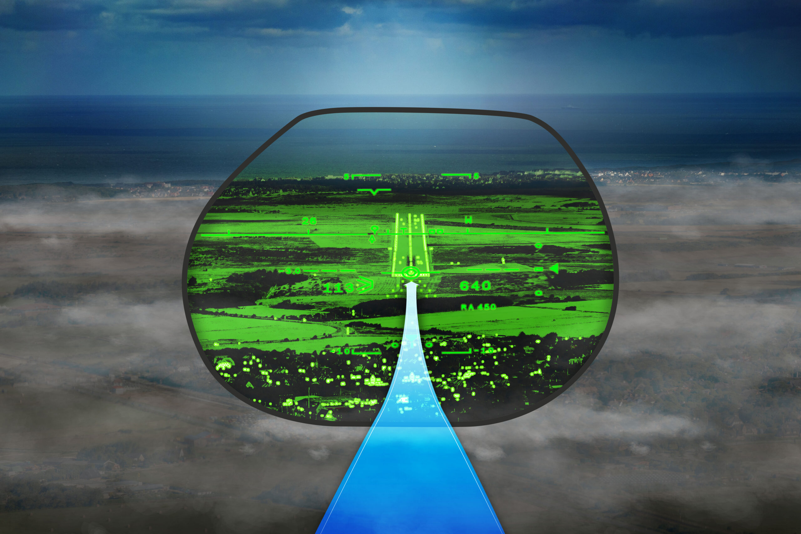
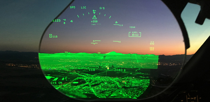
The FalconEye Combined Vision System lets you see the world like never before. It is the first HUD to combine Synthetic Vision, database-driven terrain mapping and actual thermal and low-light camera images into a single view. The result is an unprecedented level of situational awareness for flight crews. You know exactly where you are in all conditions of operation, including fog, mist, snow and other severe weather conditions, day or night. FalconEye lets you approach every mission with a greater level of confidence.
Used separately, enhanced vision systems and synthetic vision systems provide incomplete—albeit useful—information. Thermal imagery in enhanced vision is limited and won’t show the approaching terrain in certain weather conditions. Conversely, the graphical depiction from synthetic vision won’t show runway obstacles such as a wayward aircraft, fuel trucks, or animals. With FalconEye, these dangerous scenarios are immediately evident, allowing your flight crew to make the appropriate avoidance maneuvers.
Born from military technology, FalconEye is equipped with a fourth generation multi-sensor camera that generates very high definition images. These images are combined with three dedicated worldwide synthetic vision databases that map terrain, obstacles, navigation, and airport and runway data. FalconEye was developed in partnership with Elbit Systems. In synthetic vision system (SVS) mode, the camera displays a 40° horizontal by 30° vertical field of view with a 1280×1024 resolution, one of the widest angles on any HUD, ensuring full coverage of the viewing area with no tunnel vision effects. Six different sensors present the best images from both the near-visible and infrared spectrums. One, for example, can detect LED runway lighting before our naked eyes are able to. Four sensors are dedicated to light detection during daytime operations. One is dedicated to night conditions and one thermal sensor is used for terrain imaging.
FalconEye’s synthetic video image uses three dedicated worldwide databases uploaded to the HUD computer. Terrain, obstacle and navigation databases provide full view of obstacles, airport and runway data. These are then seamlessly combined to images in the visible spectrum in a unique and patented way. Nobody has yet to offer such a dynamic advantage, making this true breakthrough the only solution to provide a real enhancement in safety and situational awareness in HUD use.